

RAINY DAYS AND RECOVERY
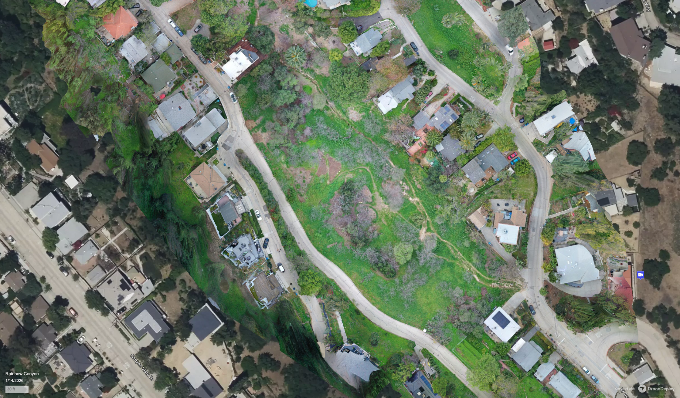
Rainbow Canyon Test Plot
By Andre Grospe
Test Plot Landscape Designer
Date: Jan 15 2026
Rainbow Canyon Test Plot
By Andre Grospe
Test Plot Landscape Designer
Date: Jan 15 2026
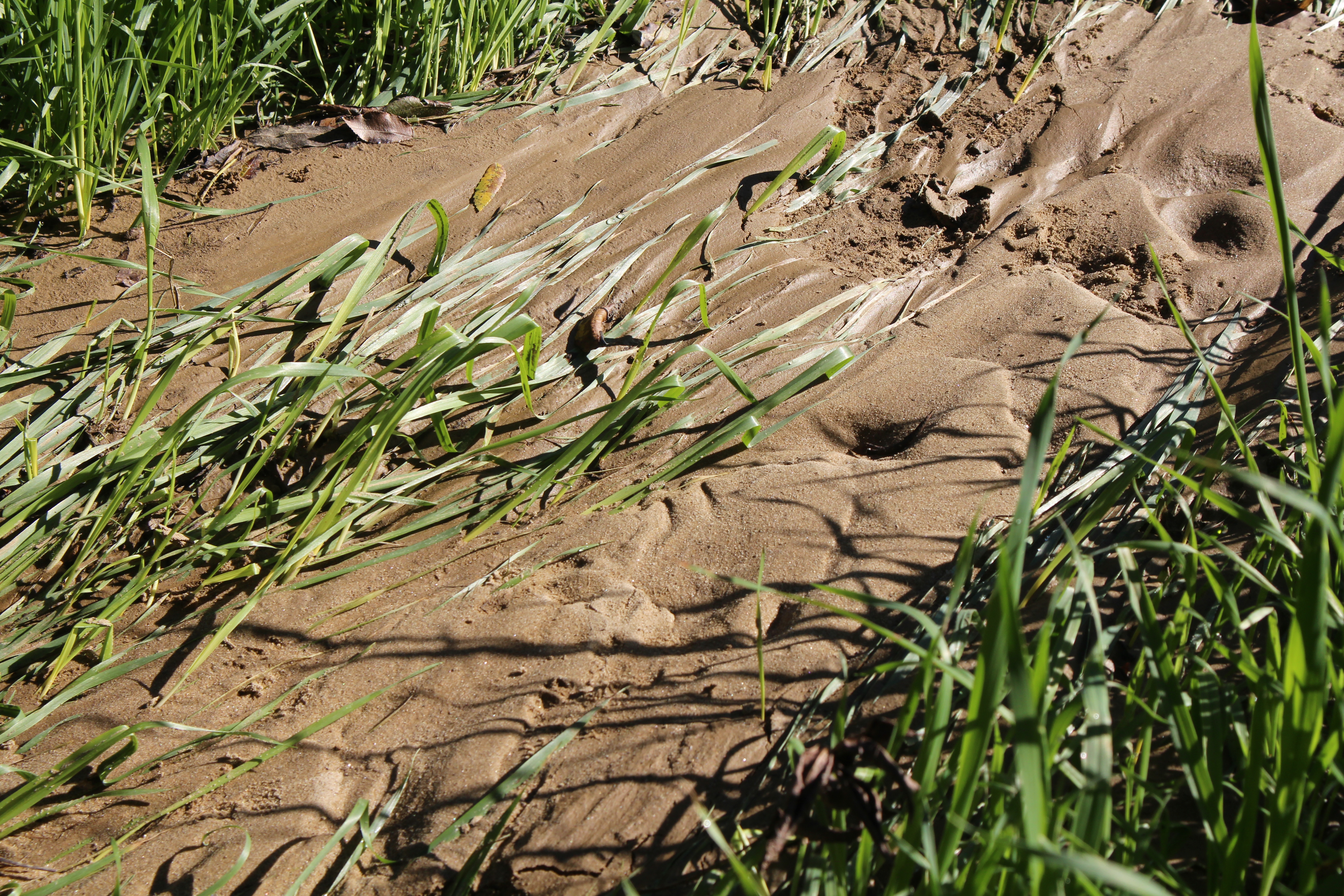
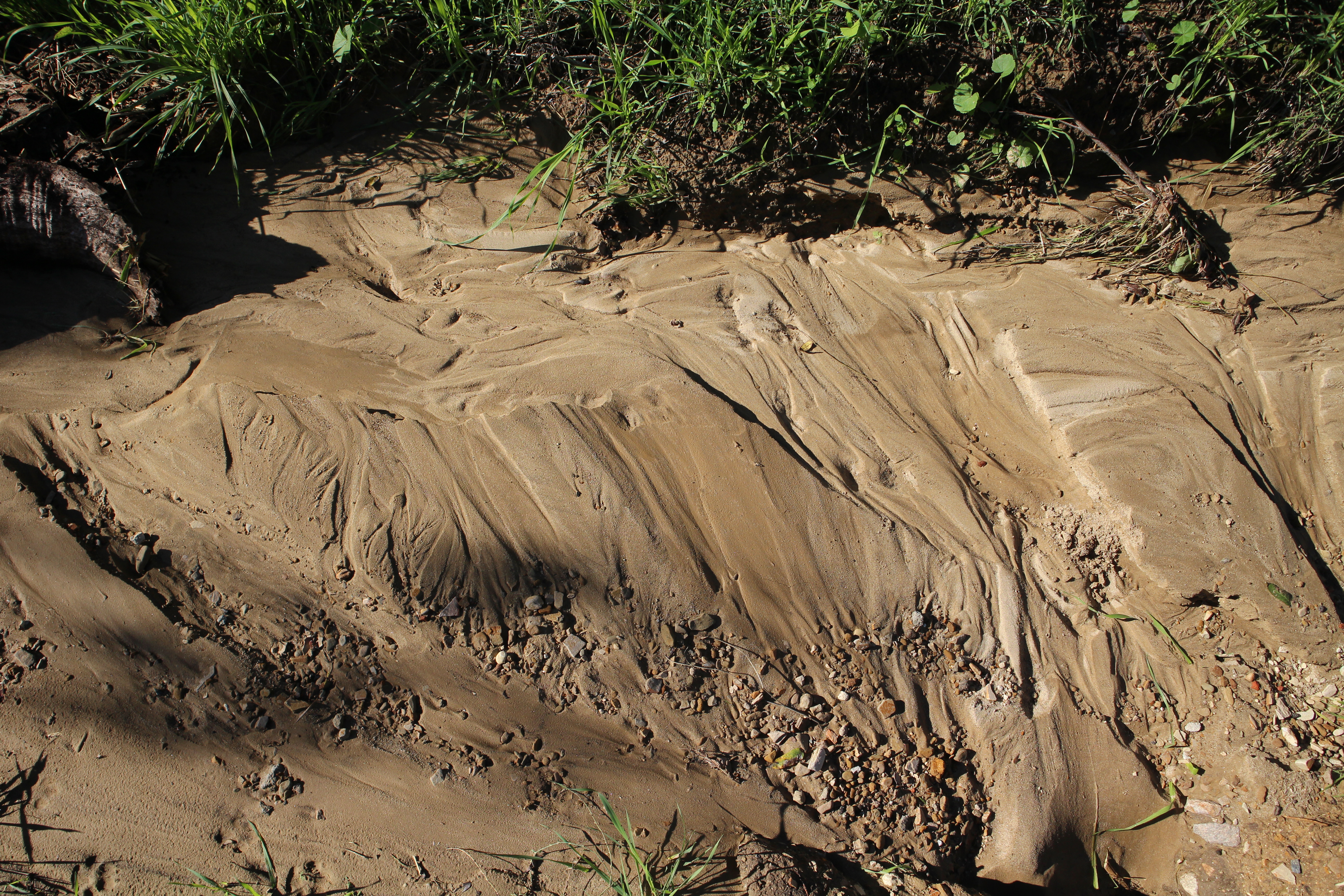
If you returned to Rainbow Canyon after these winter storms you may have noticed some changes. There are several new washes of sand, new patches of litter and debris, extra ruts in the ground, traces that something powerful came through. It can feel like forensics, seeing what’s left after a big rain and deducing what might have caused these changes. They are subtle reminders of how dynamic Rainbow Canyon can be.
Obviously this is not a unique event and heavy rains can be more a nuisance and hazard than a wondrous experience, especially to those living downstream. Previous documentation clearly shows more severe debris flows than I had seen. But these gentle and moderate rains gave me a chance to document and appreciate the nuances of a stream and what they offered to the overall experience of the lower canyon (as opposed to just focusing on the awesome and terrifying high flow events). What kind of aesthetic experiences do we gain if we implemented best management practices (BMPs) and other channel modifications?
I would suspect that most who wander in and out of Rainbow Canyon see its heavily eroded channel as an ugly scar, an obstacle to jump across, or a problem to be solved. While it is these things, it is also the product and home of an ephemeral stream that has shaped the way we design and work with the lower canyon plots.1 The entrance trails into the lower canyon are defined and continually eroded by stream diversions and have stymied and frustrated our mulch truck drivers and resulted in more than one twisted ankle. During heavy rain events sediment, logs, and other debris wash out directly onto Ave 45. Suffice it to say, this stream is a blessing and a curse and currently, with the help of a grant from the Water Foundation and Rose Foundation, we have been trying to understand and mitigate these problems. These storms have been an amazing opportunity to rigorously document these stream dynamics, testing out new methods and technologies along the way.
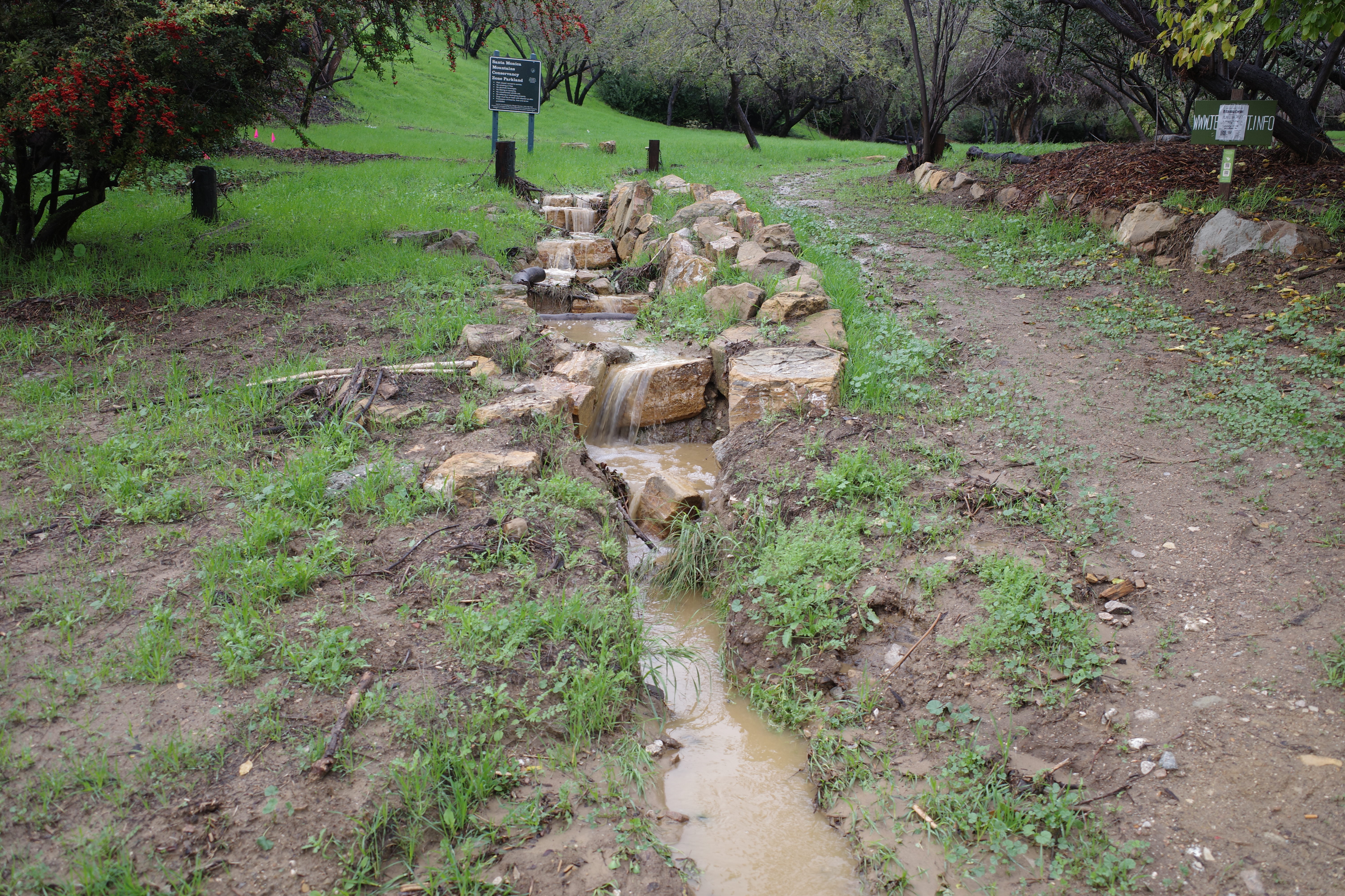
During the November 15th rain event, we ended up getting 1.65” of rain.2 When I arrived to document, the canyon wasn’t the raging river I had expected, with no water actively running through the channel. Not too long after I had arrived however, I heard a light gurgling sound and saw the fresh grasses growing in the channel begin to fold over. The smell of fresh soil filled the air. Excitedly, I was able to capture the first flush through the canyon. The water was a dark, opaque brown (think hot chocolate) but was relatively relaxed, tumbling over the roots and rocks. I followed the water out to the entrance and watched it pour over the stone steps you pass when you enter the canyon, creating a lovely set of waterfalls before emptying out onto the street.

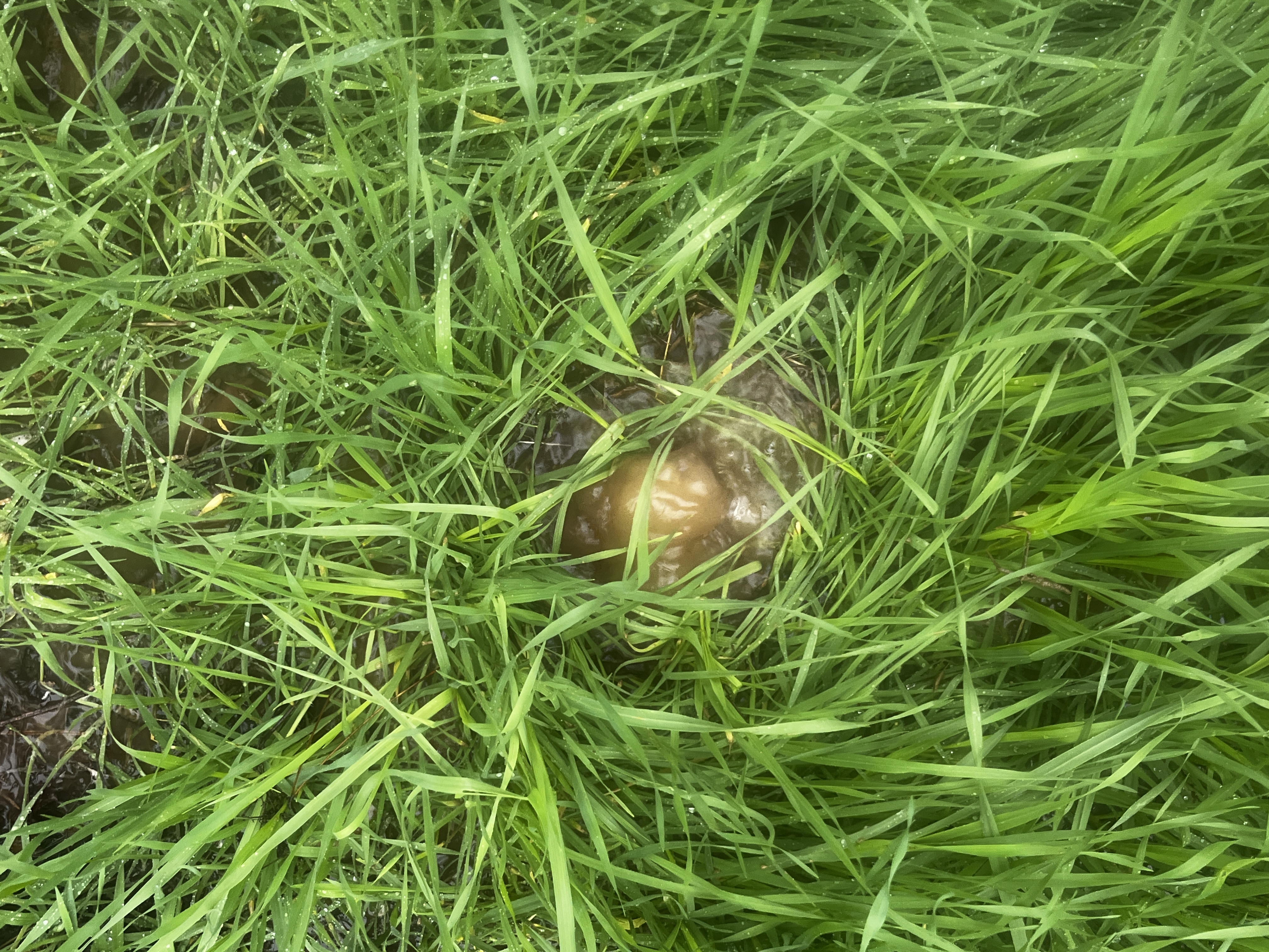
Elsewhere in the site, small springs and pipes burbled out water. I wondered if these were some of the bits of infrastructure we had found digging through city datasets or just gopher holes being flushed out. Either way, they were cute curiosities closer to the entrance of the canyon.
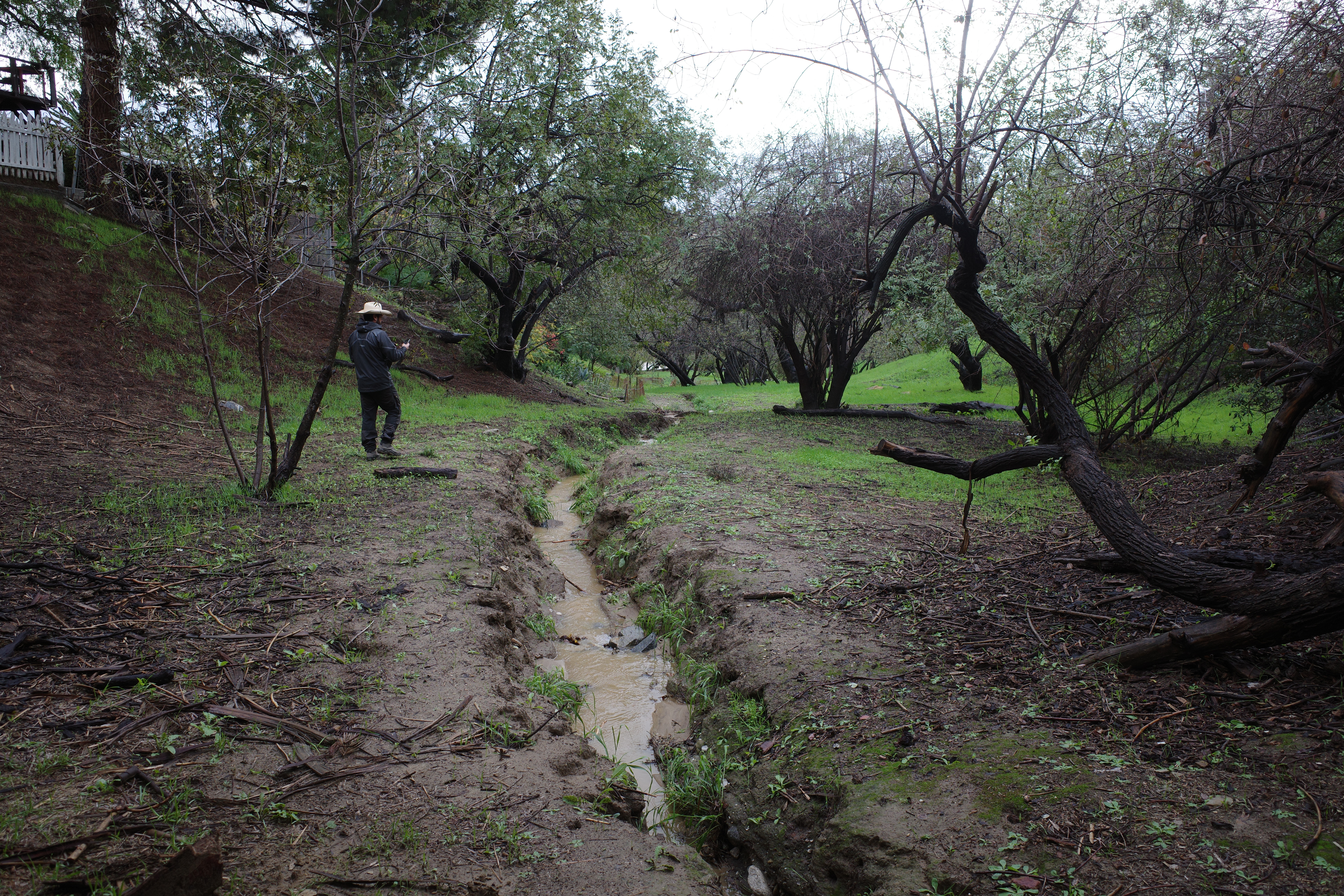
I left before the rains got heavy, but when I returned the following week, more changes than I had witnessed had obviously occurred. Over the course of the storm, water had carved a third diversion whose path left a trail of bent grass and new sand. This was a particularly useful and reassuring confirmation of our numerical modelling, which, while rough, had similar flow patterns during lower and higher flow events.

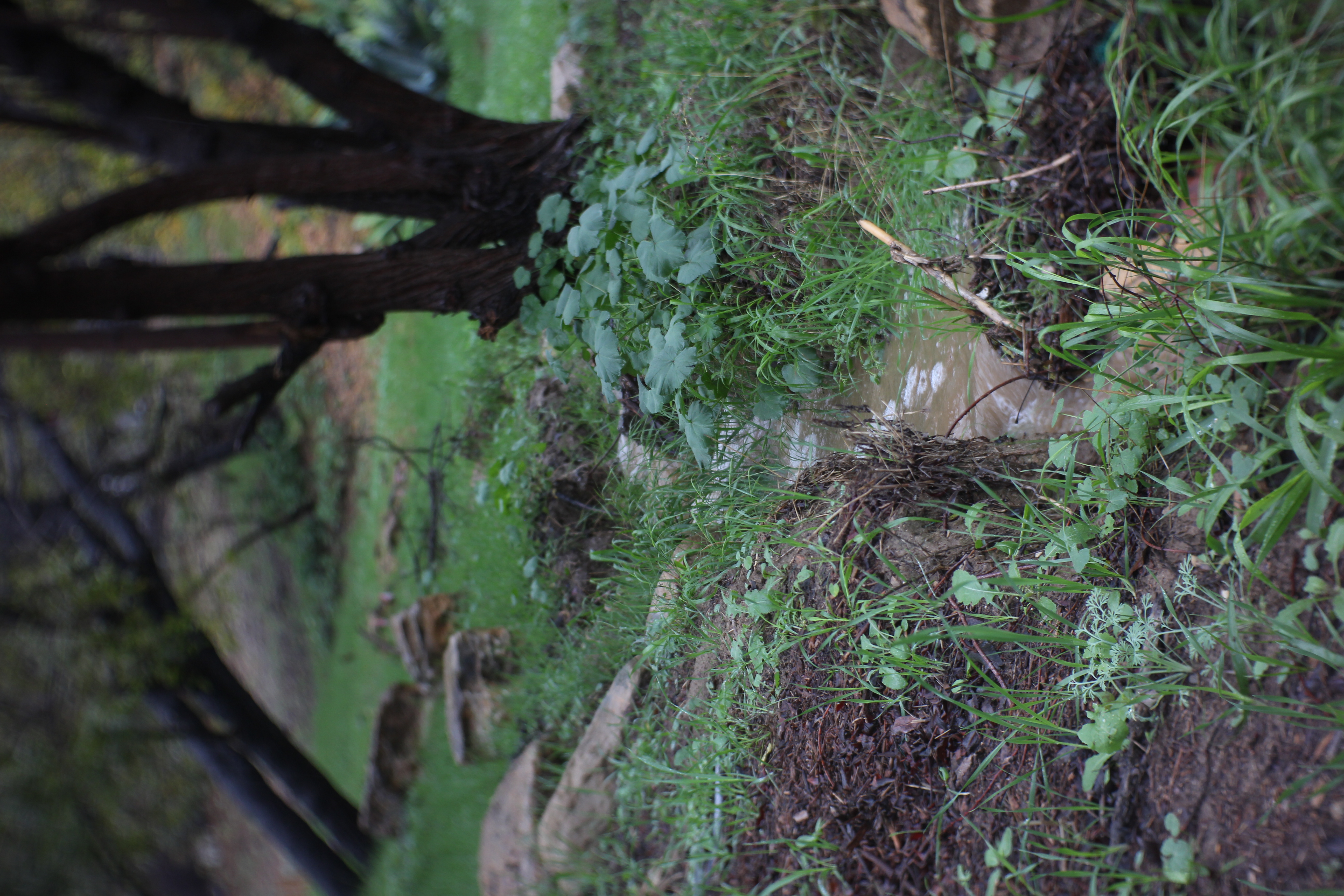
The water had also left an array of beautifully complex depositional forms, some sinuous and fan-like, showing where water crossed and flowed around different obstacles. Others were soft, dramatic, pillowy ripples, particularly in the stone steps at the entrance, where the waterfalls created stirring eddies that caused sediment to slowly accrete in the pool. Some parts of the channel seemed to fill up with sand.
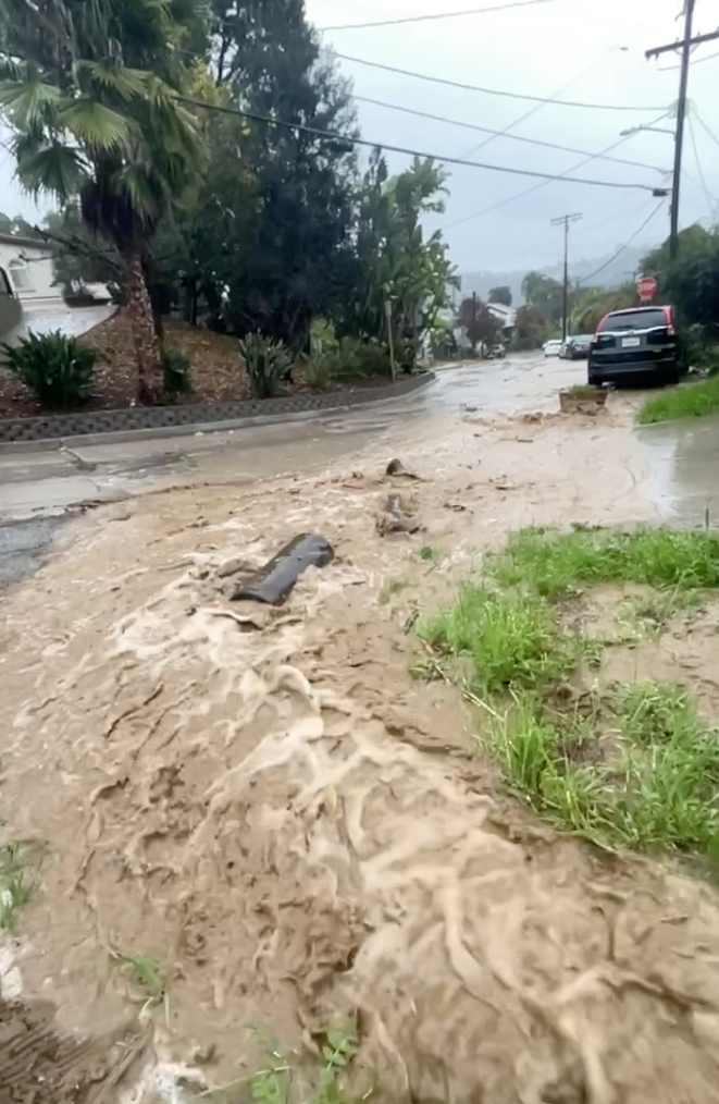
The next rain event of 2025, on Christmas Eve, was a much larger one, almost 2.6 inches in the area. Following the LA County Hydrology Manual, that would make this an almost exact 2-year rain event in the Mount Washington area.3
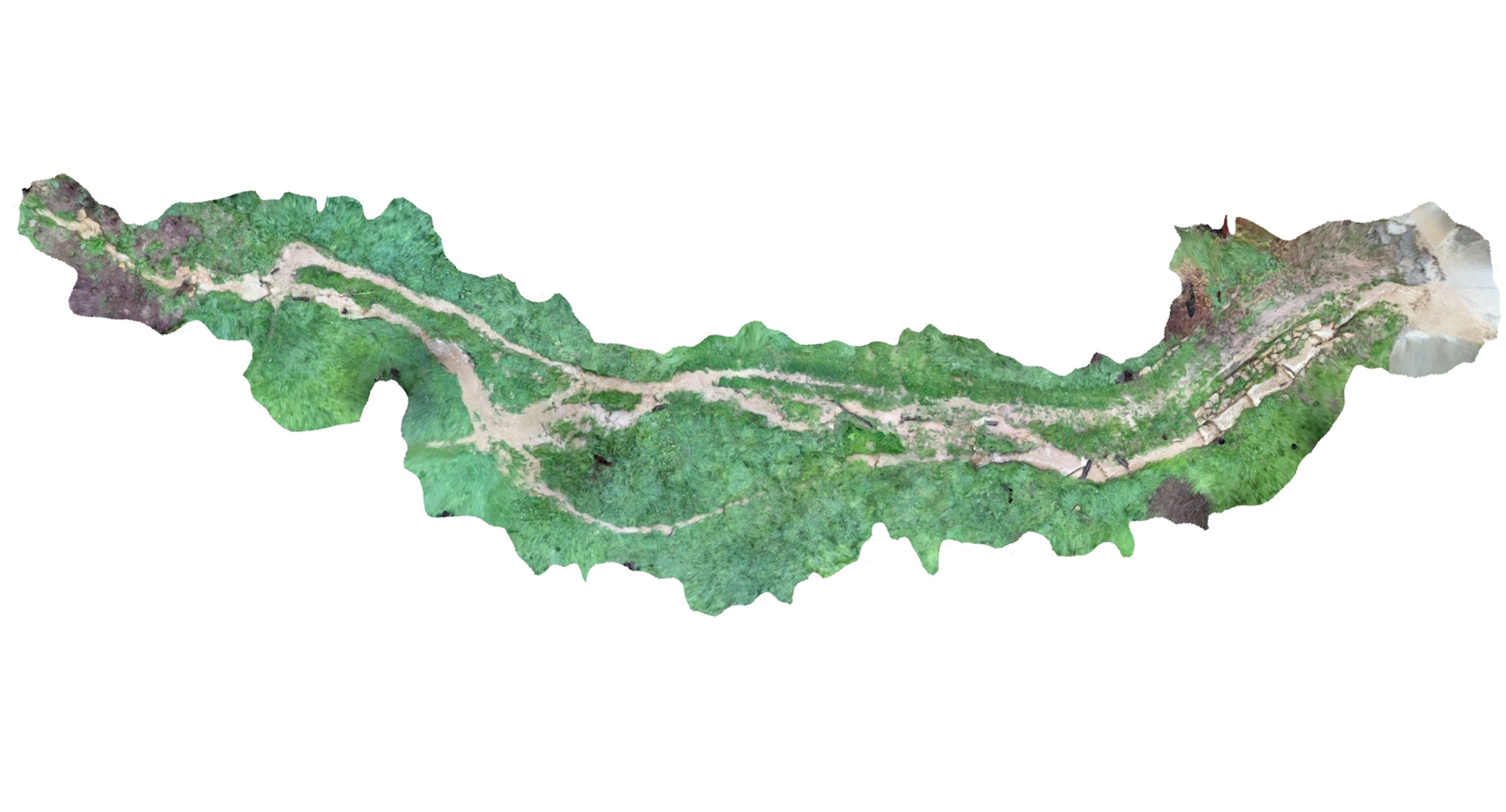
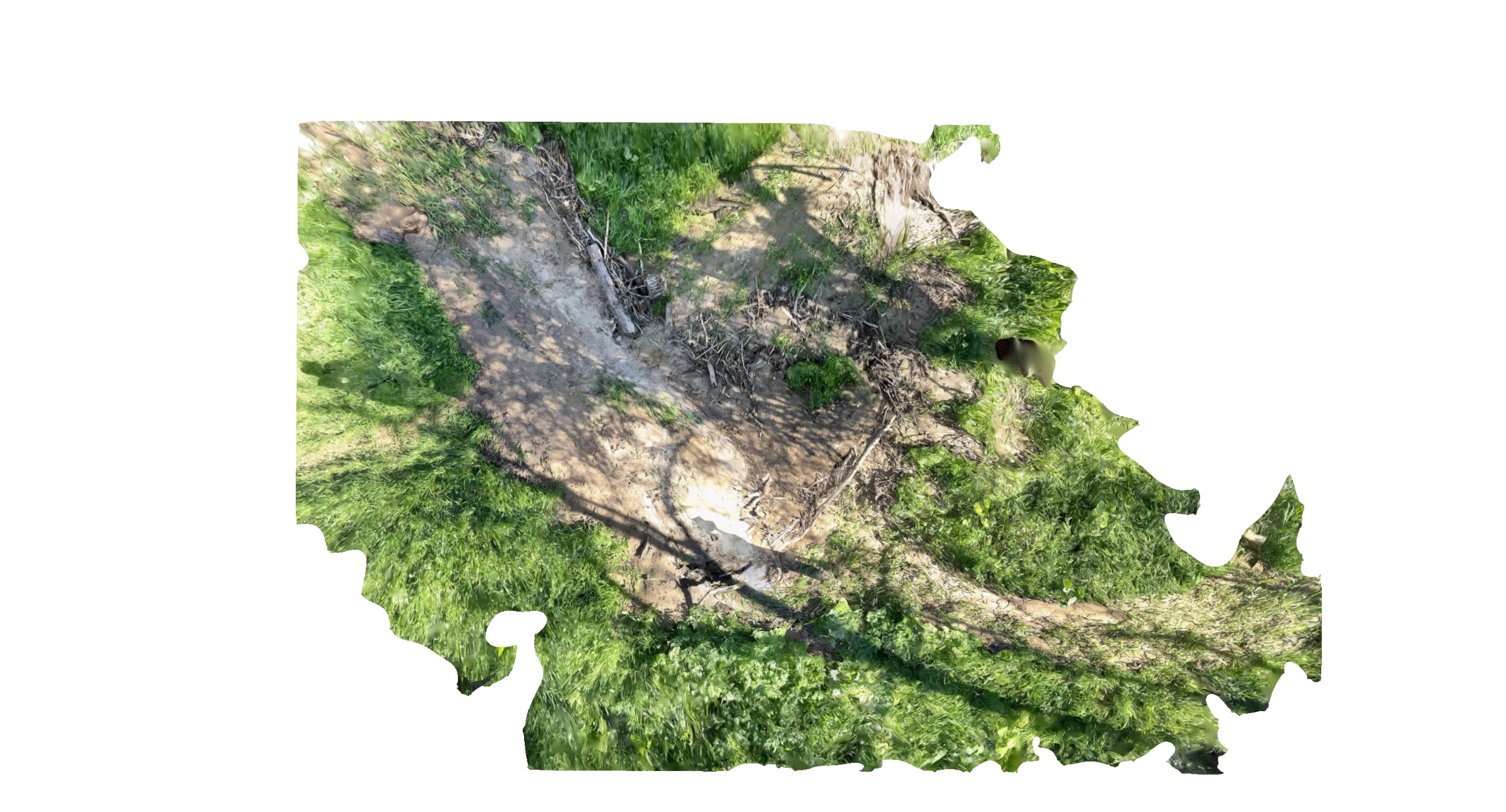
With November’s fieldwork in the back of my mind, I returned with a better camera (a mistake) and a focus to try to capture the nuances of the flow. I had a goal to connect the flow of water to some of the depositional forms I saw in November. I also wanted to try a new monitoring technique, using an iPad’s lidar scanner and Polycam to stitch together a plan of the flow path which worked well even despite some of the tall grass and standing waves confusing the software a bit.
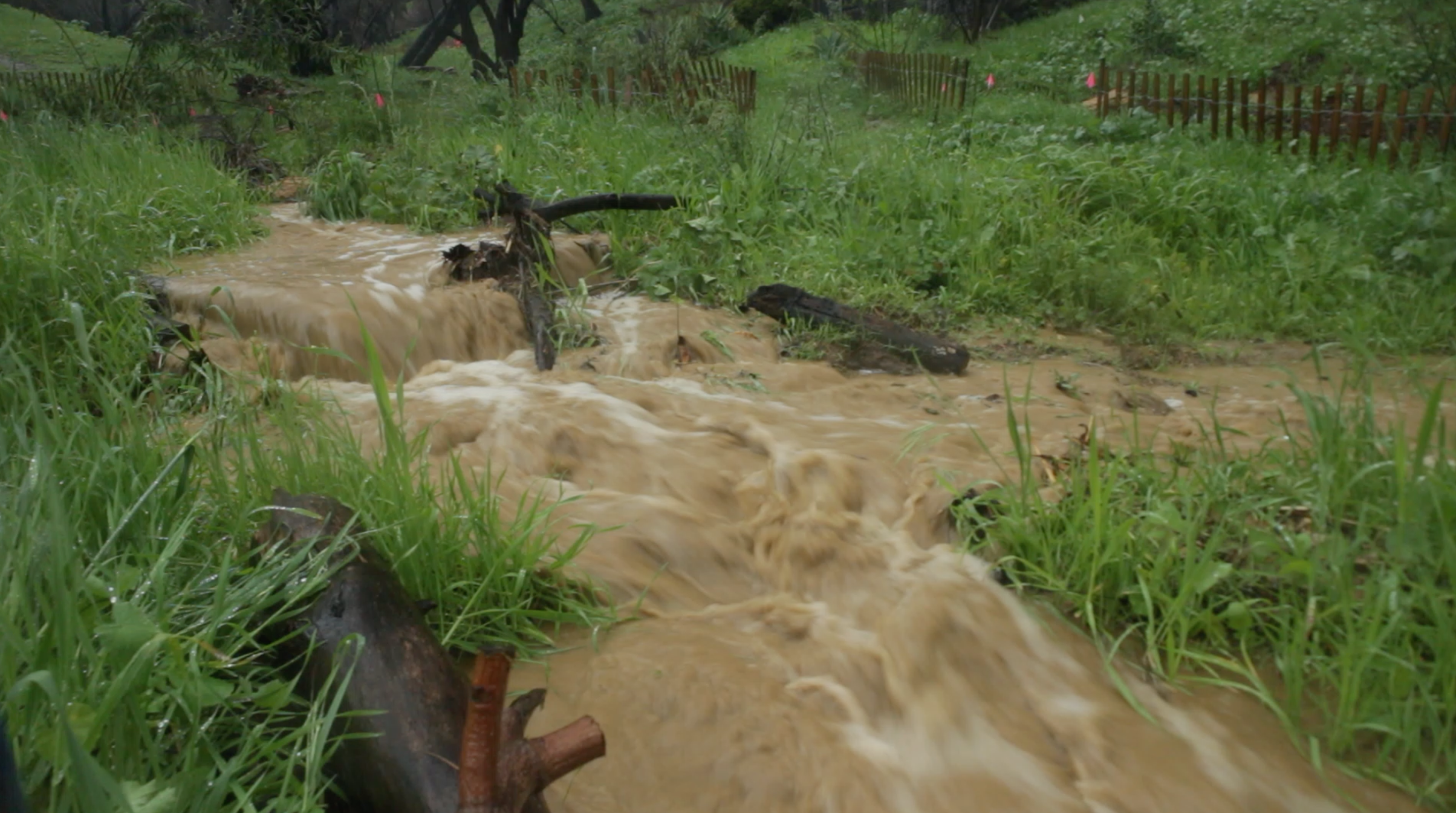
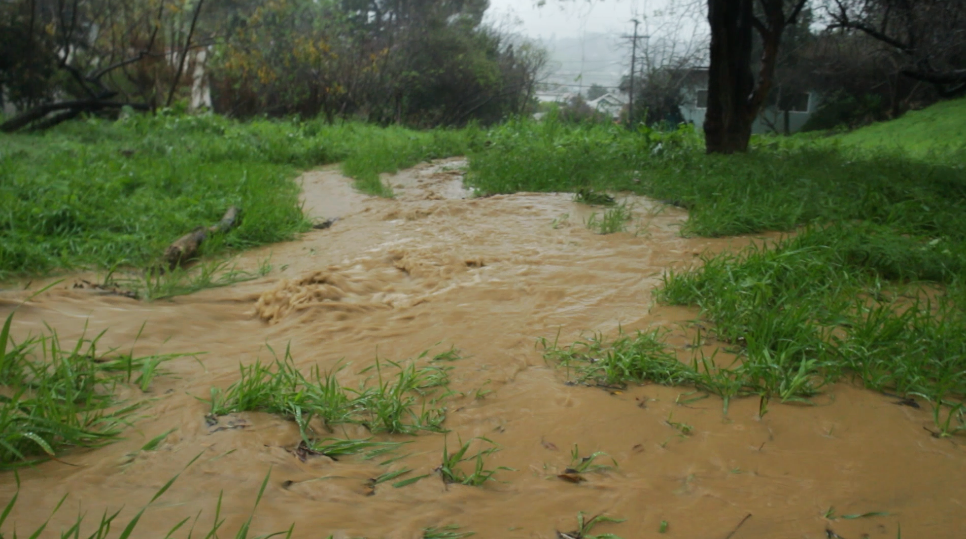
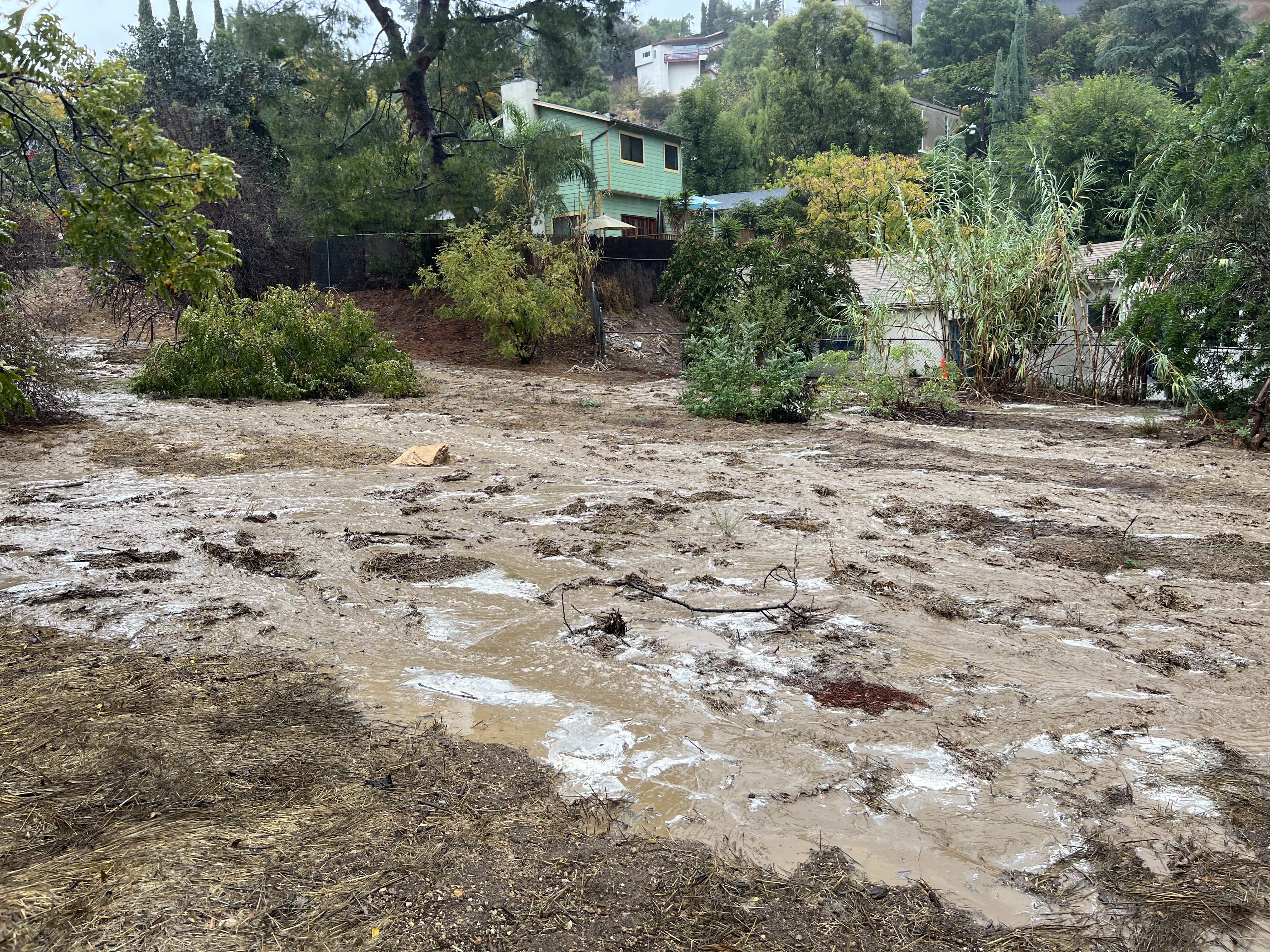
Christmas Eve’s storms were intense and unpredictable. The channel was nearly full to the brim with water whipping around rocks and logs. The stone steps at the entrance were overflowing, spilling out onto either side of its walls. Large flashes of water came in pulses, signaled first by sound, then by color as the stream darkened with new sediment.
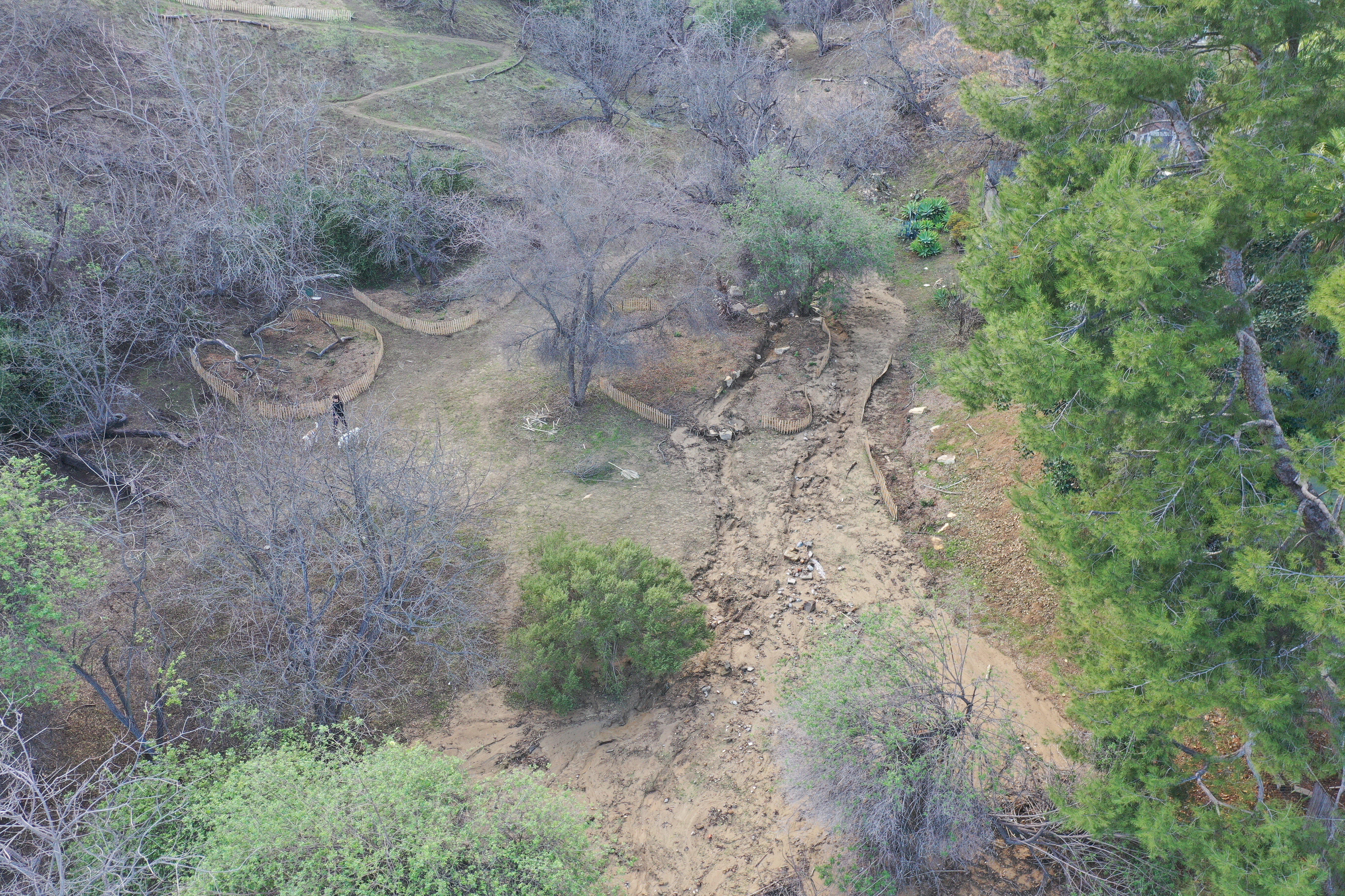
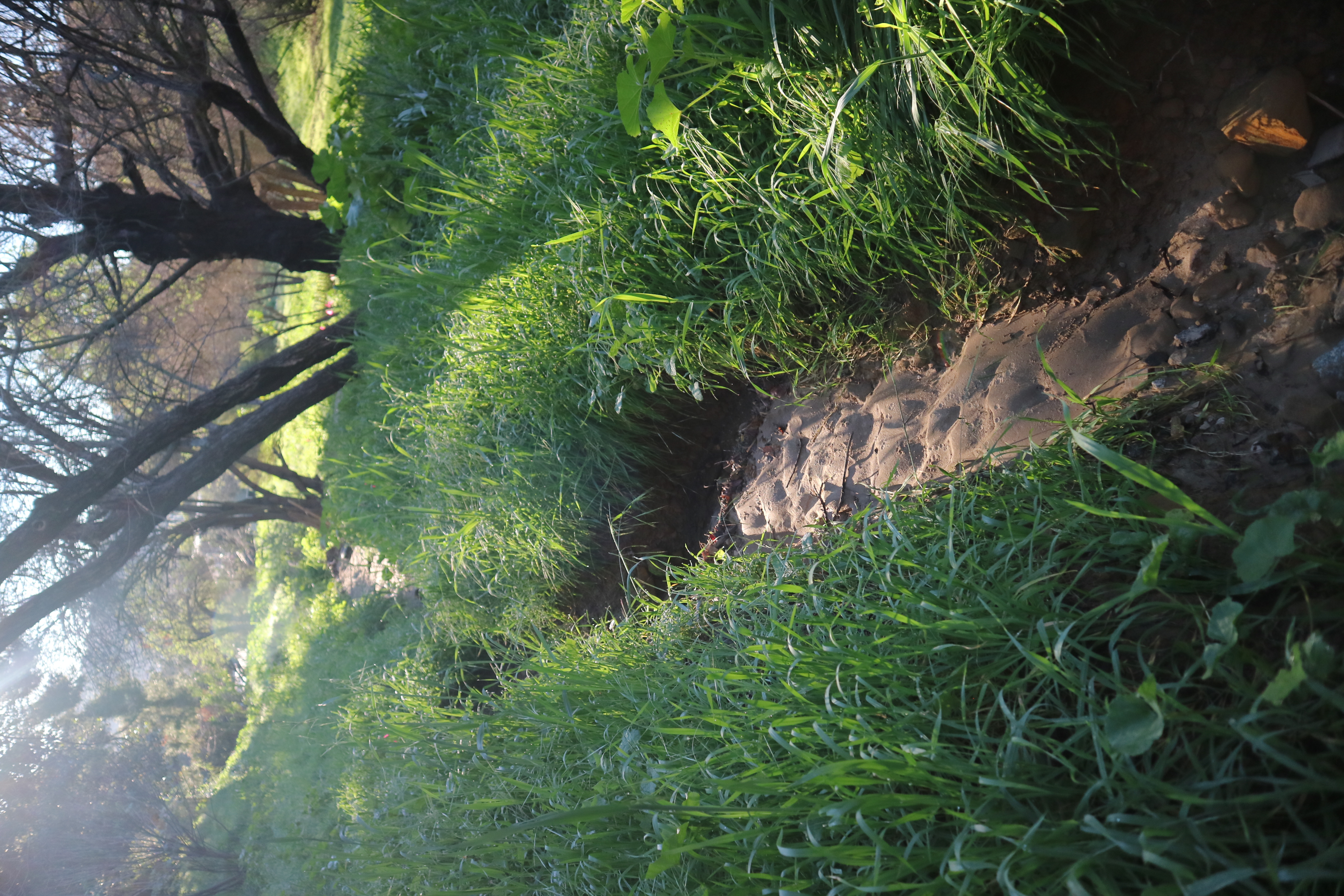
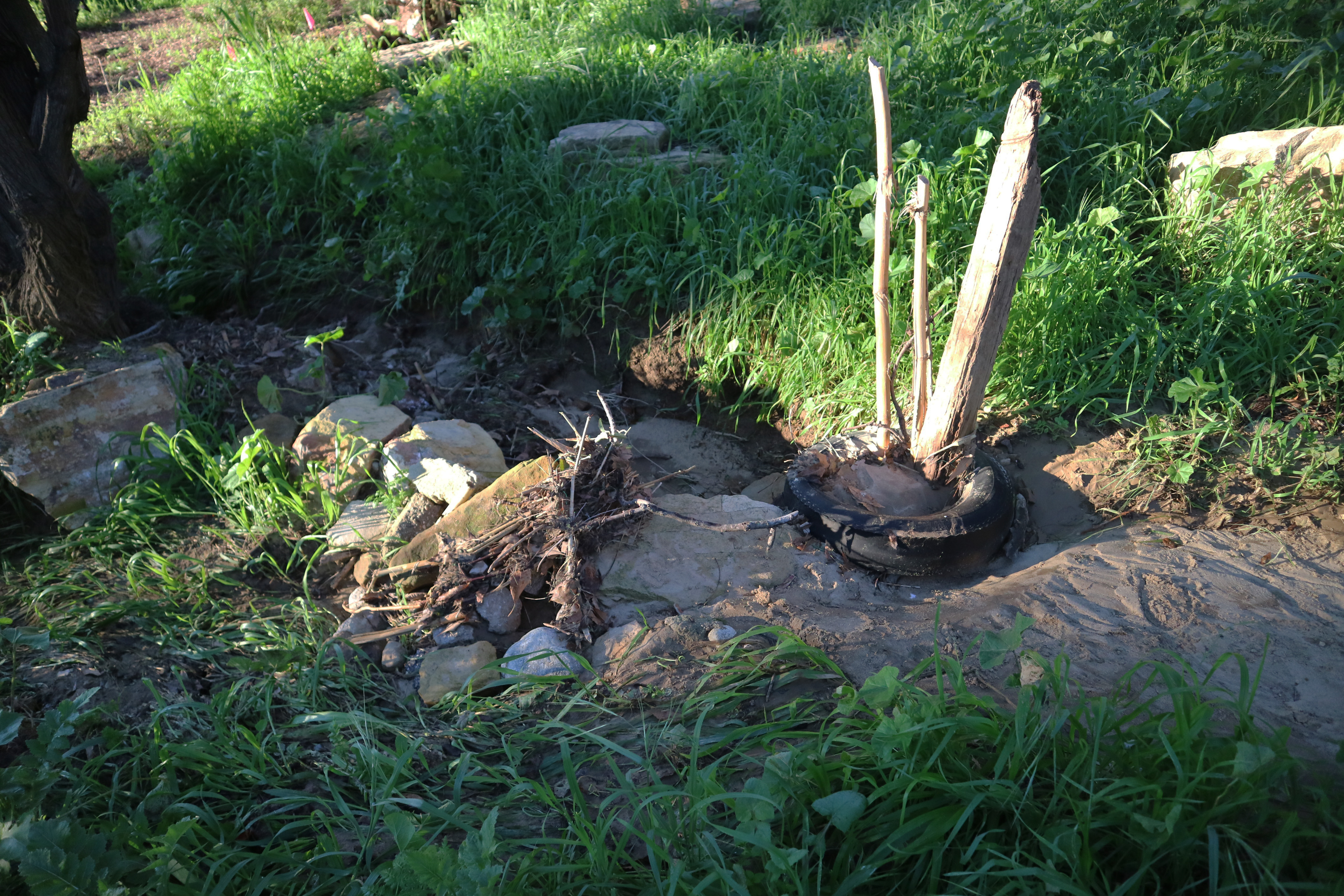
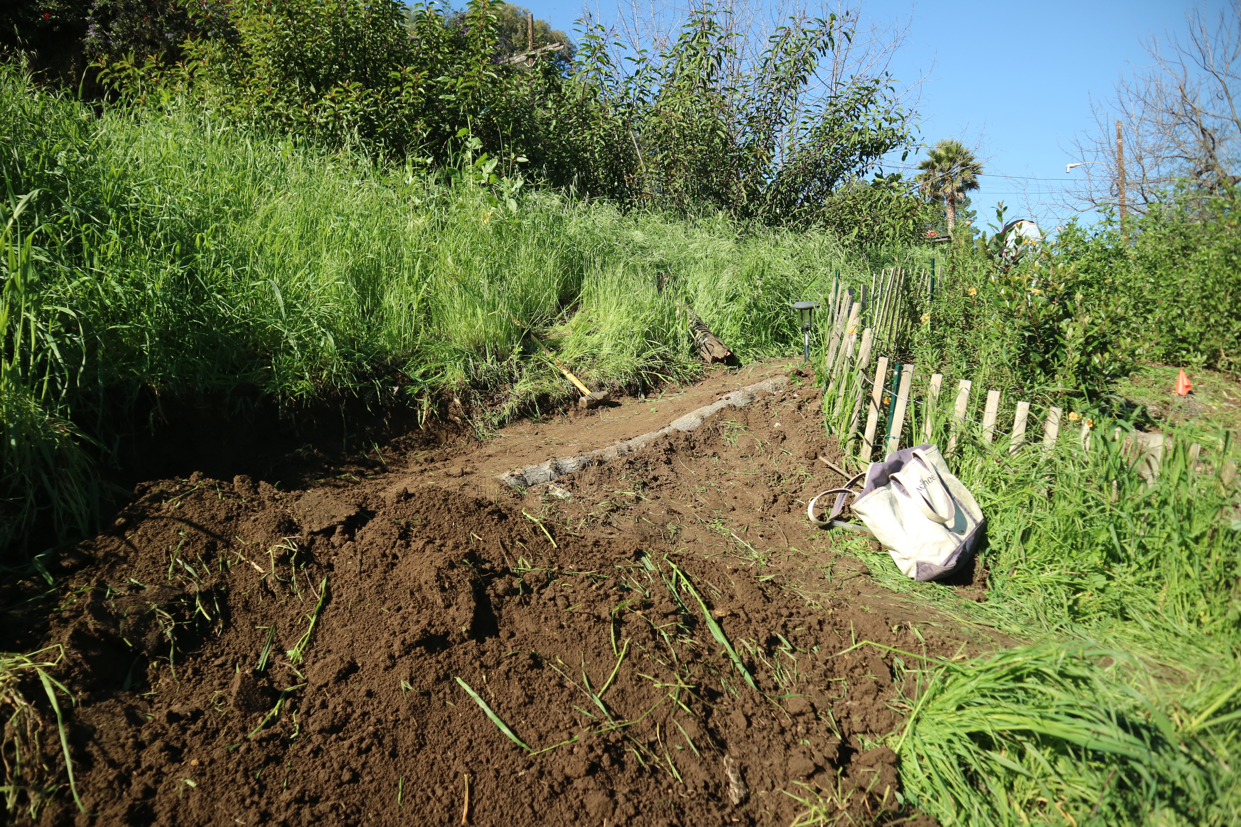
When I returned after the storms, on our first workday of 2026, the canyon had again been noticeably rearranged. A tire lodged itself in front of the riparian plot, causing an extreme buildup of sediment, creating a new sand bridge to cross the channel. But the tire had also diverted water onto the trail between the riparian and fire buffer plots, further degrading it.
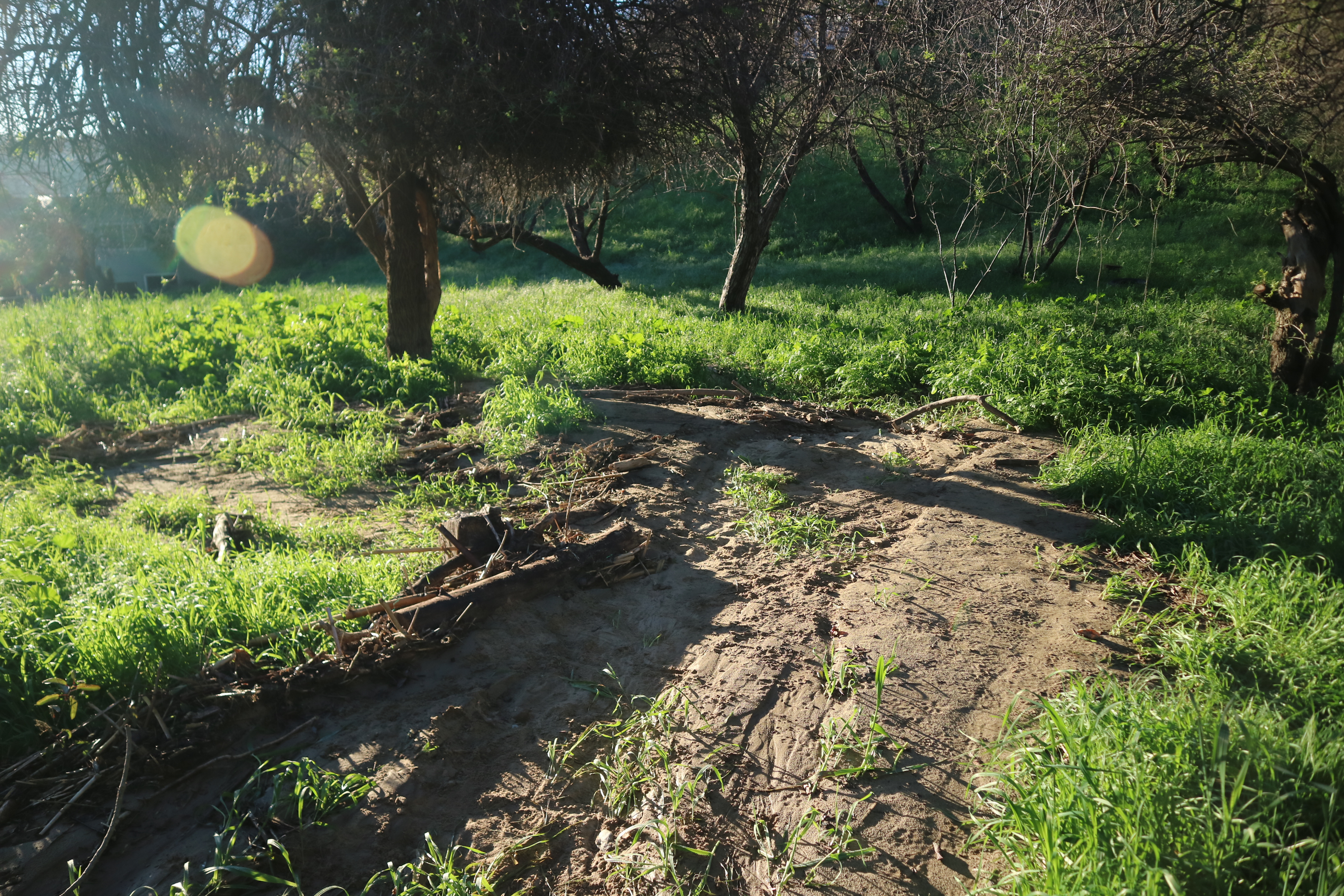
Upstream of the riparian plot, the channel continued to transform into a gulley with a defined headcut that continues to erode and deepen the channel. Left unchecked, this section will continue to deepen and retreat upstream.

Further downstream past the riparian plot was a new deposit of sand. Logs and debris seemed to have blocked the typical flow path, redirecting the water further away from the trails. Formerly this tributary would only flow during higher storm events, but with the current debris blocking the way this could be the start of a new flow direction. It will be something to keep an eye on during the next rains. How will water interact with this loose material? It will be an unpredictable and exciting experiment. Will we remove the newfound debris or leave it in place to train a new flow path? To be determined.

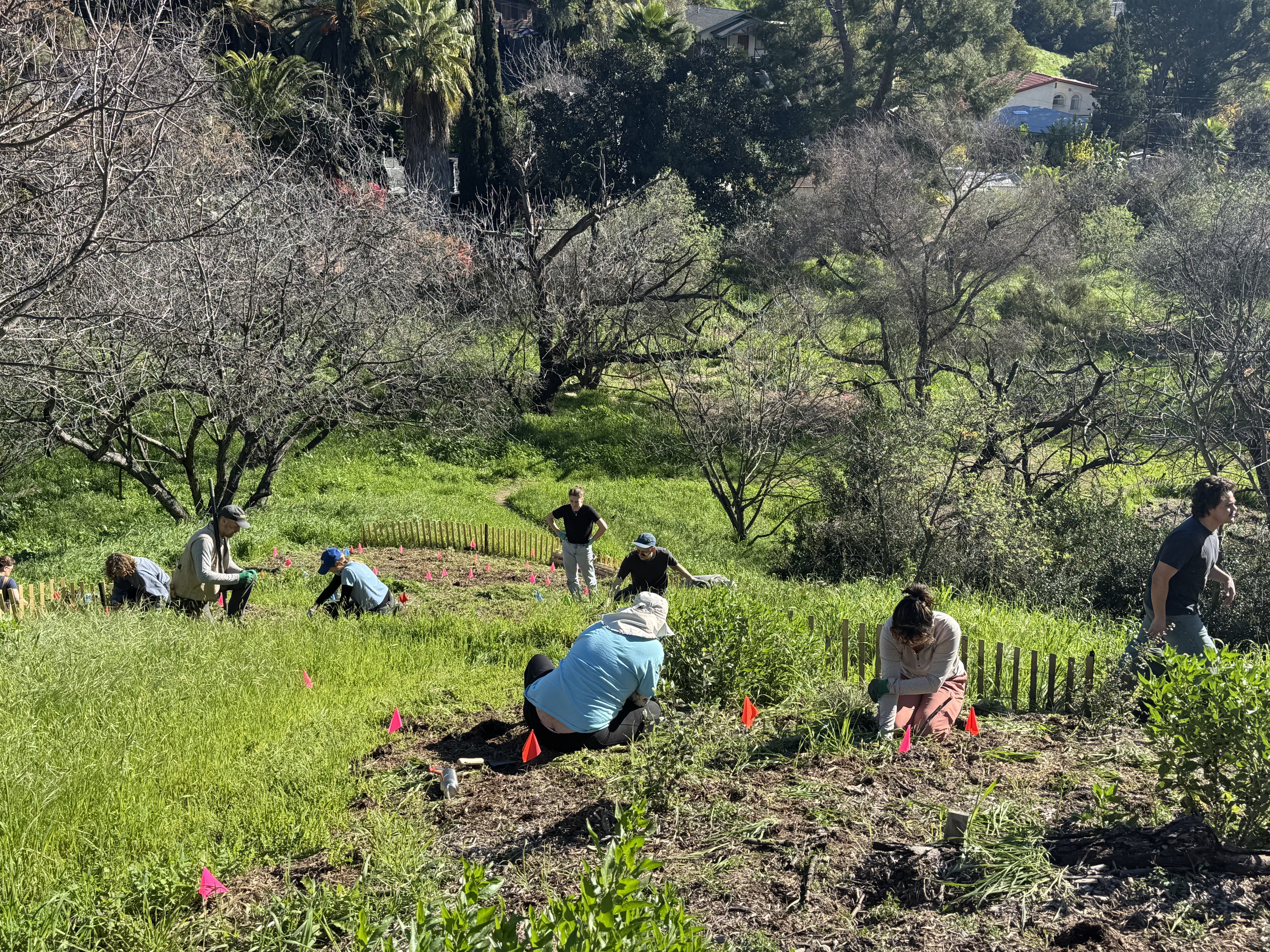
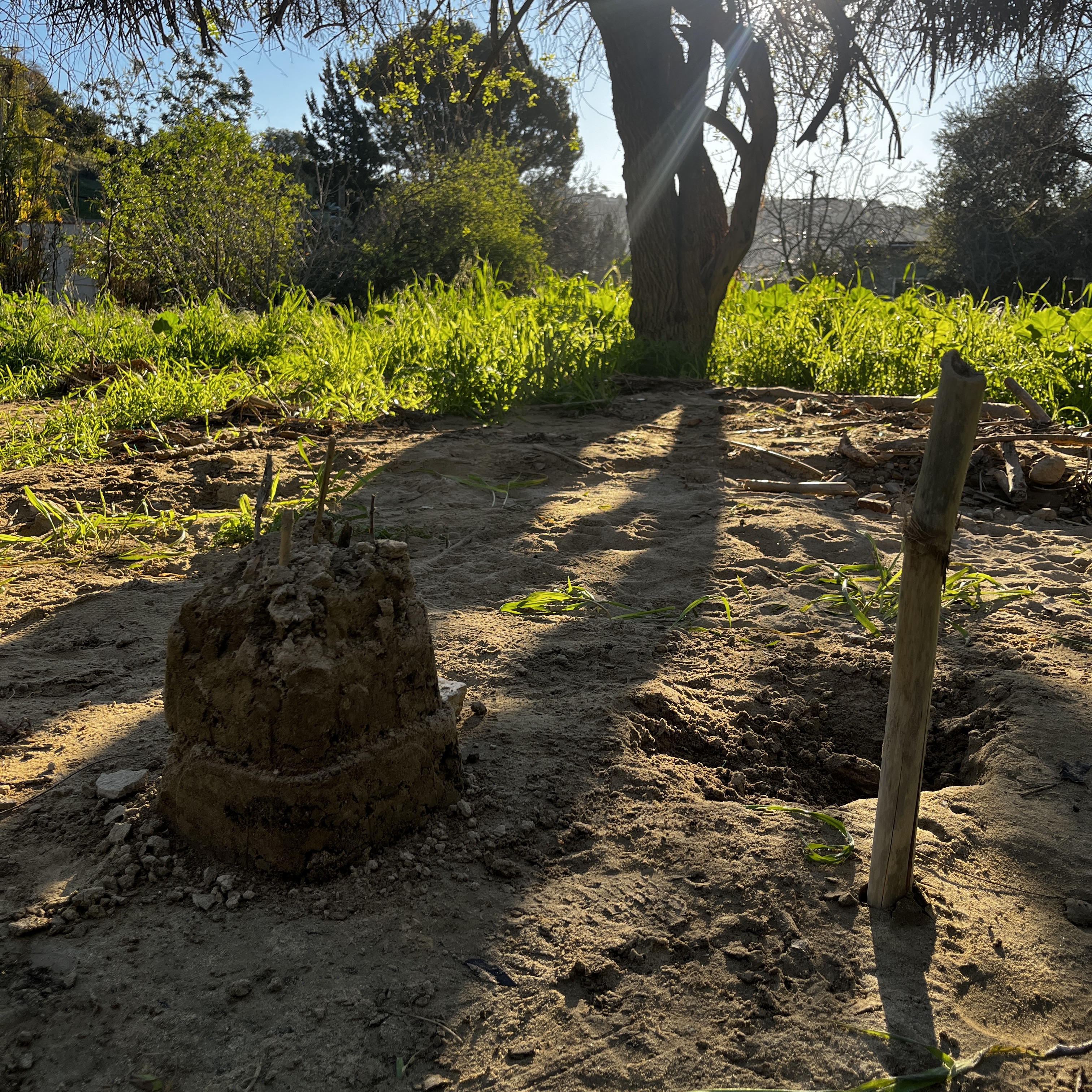
In the meantime, volunteers at the 1/10 event, mostly returning visitors, got right back to work mulching and weeding the switchback plots. Alex and Isaac installed logs and drainage to reinforce the switchbacks. Alex sprinkled wildflower seed in trail spoil. The elderberries are sprouting new leaves and flowers are beginning to bloom. I look forward to tracking their progress through the spring. After our work session finished, a family came down to the new sand wash and started to make sand castles. The next few sessions will focus on recovering and repairing from these storms and preparing for the next, whether they be next month or next year.
Storm flows in Rainbow Canyon are no joke with flash floods being fast, unpredictable, and dangerous. But in a moderate rain event canyons like Rainbow Canyon activate in surprising ways. I hope some of you get a chance to swing through and maybe even linger (the dense branches of the elderberry and palm tree make good site umbrellas). Open spaces like these give us Angelinos a way to observe rain and flowing water in a different way, not just rushing past curbs and concrete lined channels, but as dynamic natural features that continue to alter the landscape. Fingers crossed for more rains in 2026. When they come you know where I will be!

1 From the EPA, “An ephemeral stream has flowing water only during, and for a short duration after, precipitation events in a typical year. Ephemeral stream beds are located above the water table year-round. Groundwater is not a source of water for the stream. Runoff from rainfall is the primary source of water for stream flow.” This is opposed to an intermittent stream which relies on groundwater and is only supplemented by rain. The more you know! https://www.epa.gov/sites/default/files/2016-02/documents/realestate_glossary.pdf
2 https://www.weather.gov/wrh/climate?wfo=lox
3 https://www.arcgis.com/apps/PublicInformation/index.html?appid=cd5ec68b636f4e47bbba5b8e9307be1e
https://lacreekfreak.wordpress.com/2010/12/22/how-to-figure-out-a-fifty-year-storm-and-other-storms-too/