CATALINA SOIL TEST #1
Green Ravine Test Plot
Q&A by Jen Toy with Emersyn Klick and Alia Harris
Environmental Studies undergraduate students at USC
Date: September 19 2023
Jen: Can you please start by introducing yourselves?
Emersyn: My name is Emersyn and I’m a junior Business Administration major with a minor in Environmental Studies at USC. I’m from Northern California and my hobbies include dancing and hiking.
Alia: My name is Alia and I’m a sophomore studying mechanical engineering with a minor in environmental studies at USC. I’m from Oregon and I play basketball, make jewelry, and I love doing anything outside.
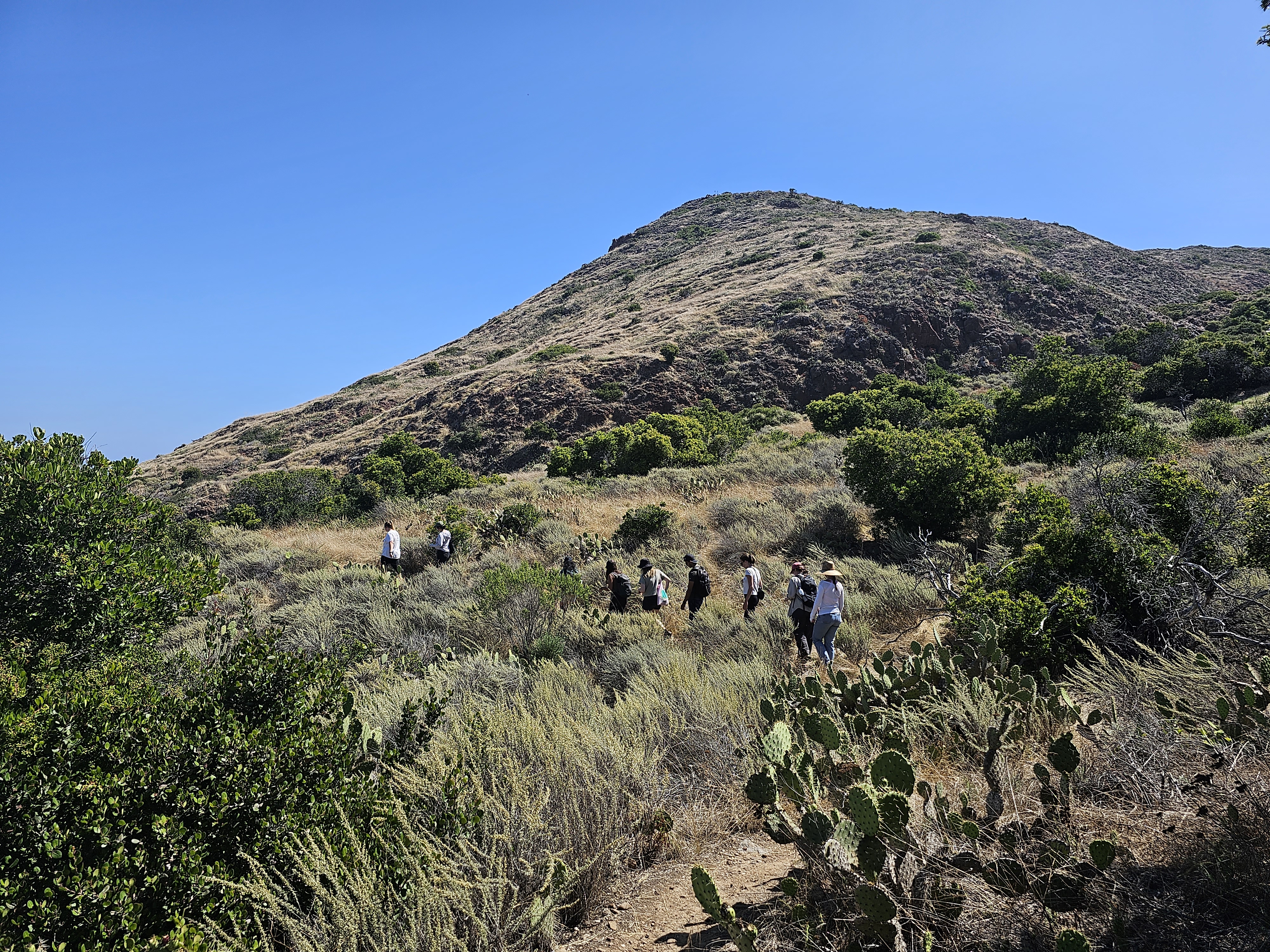
Emersyn: Catalina Island has a very similar feel to much of California’s natural landscape with a chaparral environment, but with some unique wildlife and a serenity that is unlike the mainland. Because much of the island is part of the Catalina Island Conservatory or a Marine Protected Area, you become immersed with the wildlife. Outside of Avalon, it feels rather remote on the island, in the best way possible, despite being only 22 miles from California’s mainland.
Jen: Can you describe the Green Ravine? Where does it sit on the island? What is the ecosystem? How does it relate to the Wrigley Campus?
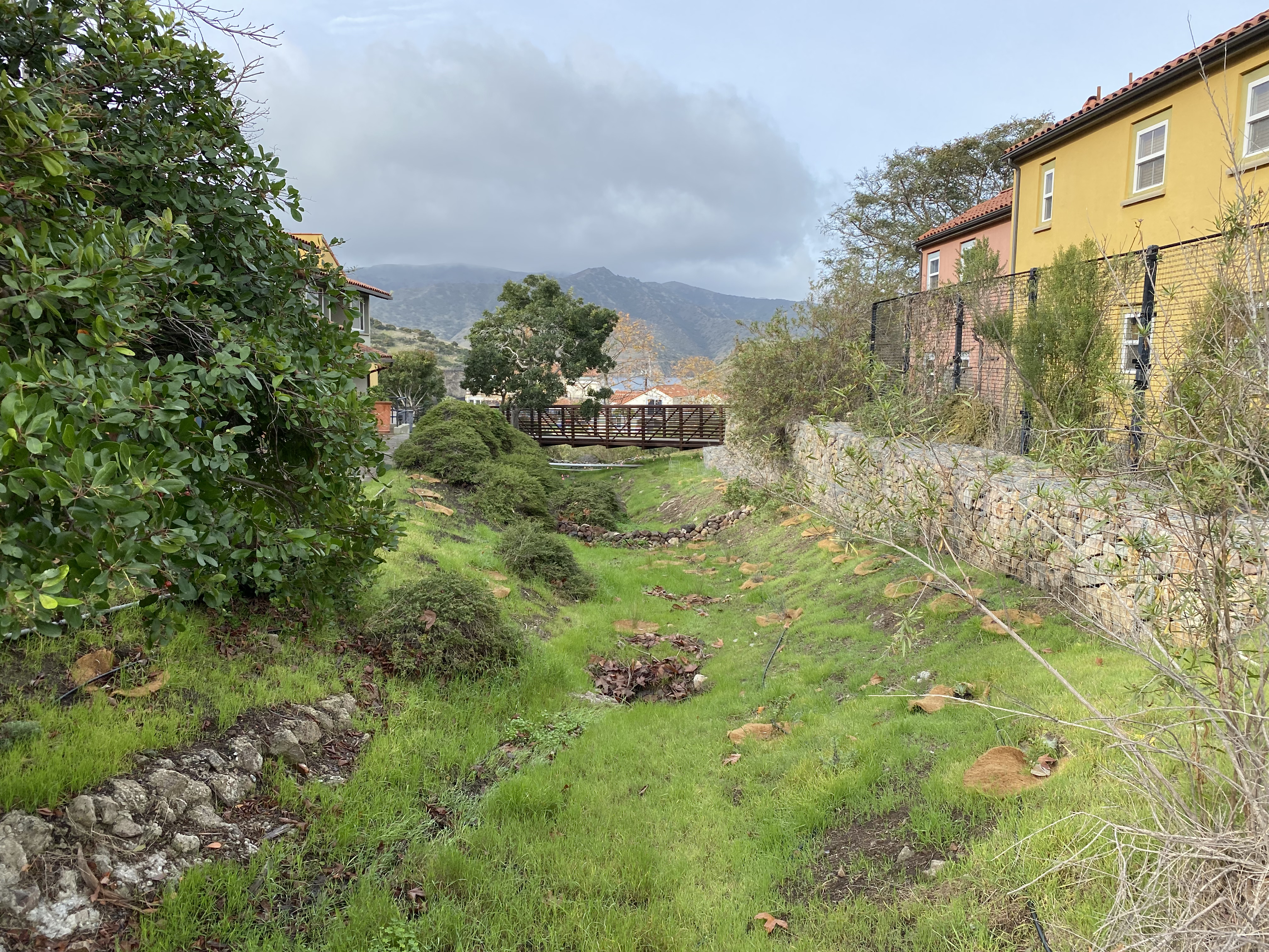
Emersyn: The Green Ravine is part of one of the lowermost sections of a watershed, located on the USC Wrigley Institute outside of the dorm style housing. A watershed is an area bound by ridges in the land above where water falls and converges to one point. More generally, the Wrigley Institute is located in Big Fisherman Cove near the town of Two Harbors. The ecosystem on the Island is of a chaparral biome, meaning that it has hot, dry summers with mild, rainy winters, creating an overall arid landscape with many native drought resistant shrubs. At the time of our data collection, the Green Ravine had a mix of both native and invasive plant species.
Jen: What were your objectives in taking soil samples?
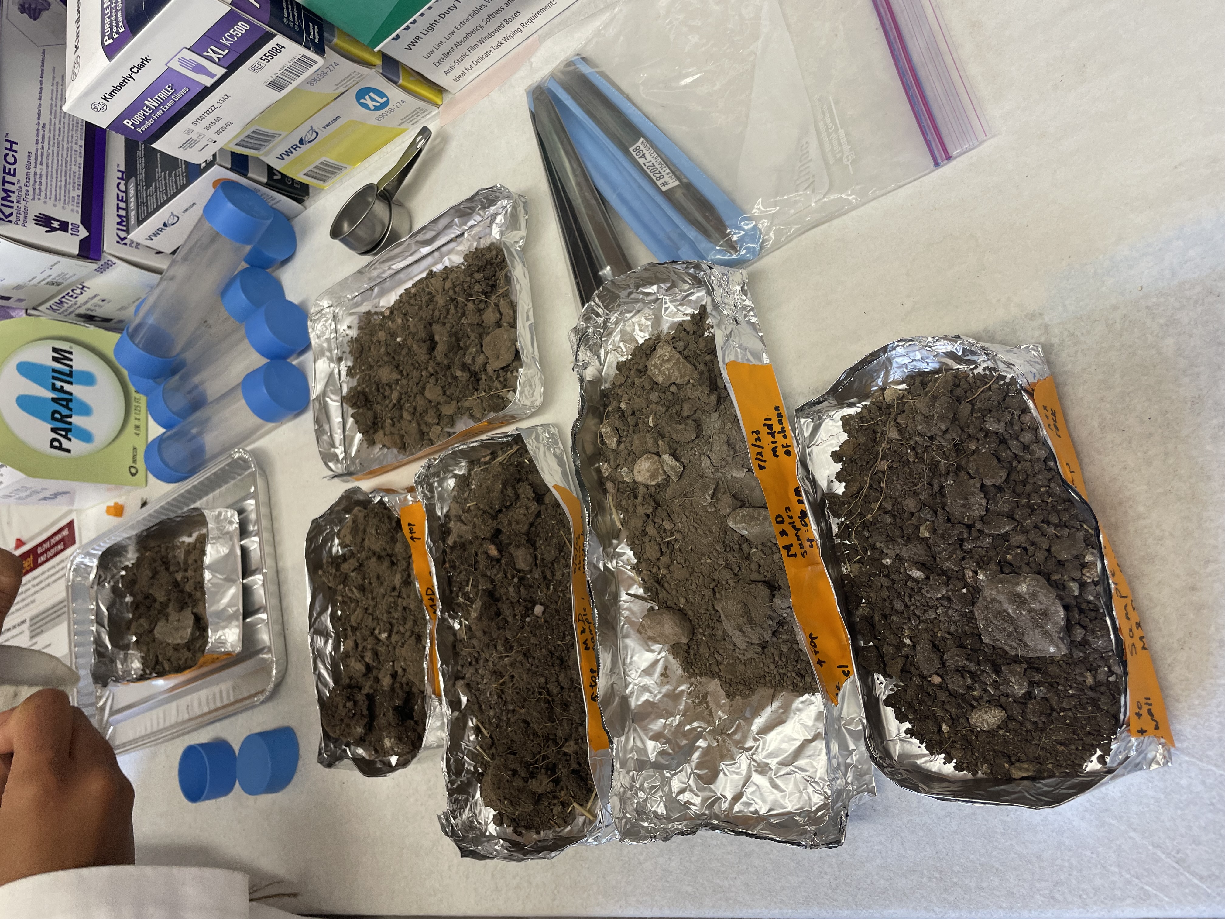
Alia: When taking soil samples, we had the objective of determining whether or not the soil would support a restoration of native plants, and if there would be anything that would be needed to be done to it in order to support more lush plant life. We wanted to assess the current health of the soil. This would set a baseline for comparison after native plants were put into the area. It would also help us understand the conditions of the surrounding watershed in addition to the green ravine. When we took samples, we had to take them in a mostly random distribution because the area is so rocky, and we had trouble getting our equipment to penetrate the ground in a lot of places.
Jen: Can you describe what did the soil look and feel like?
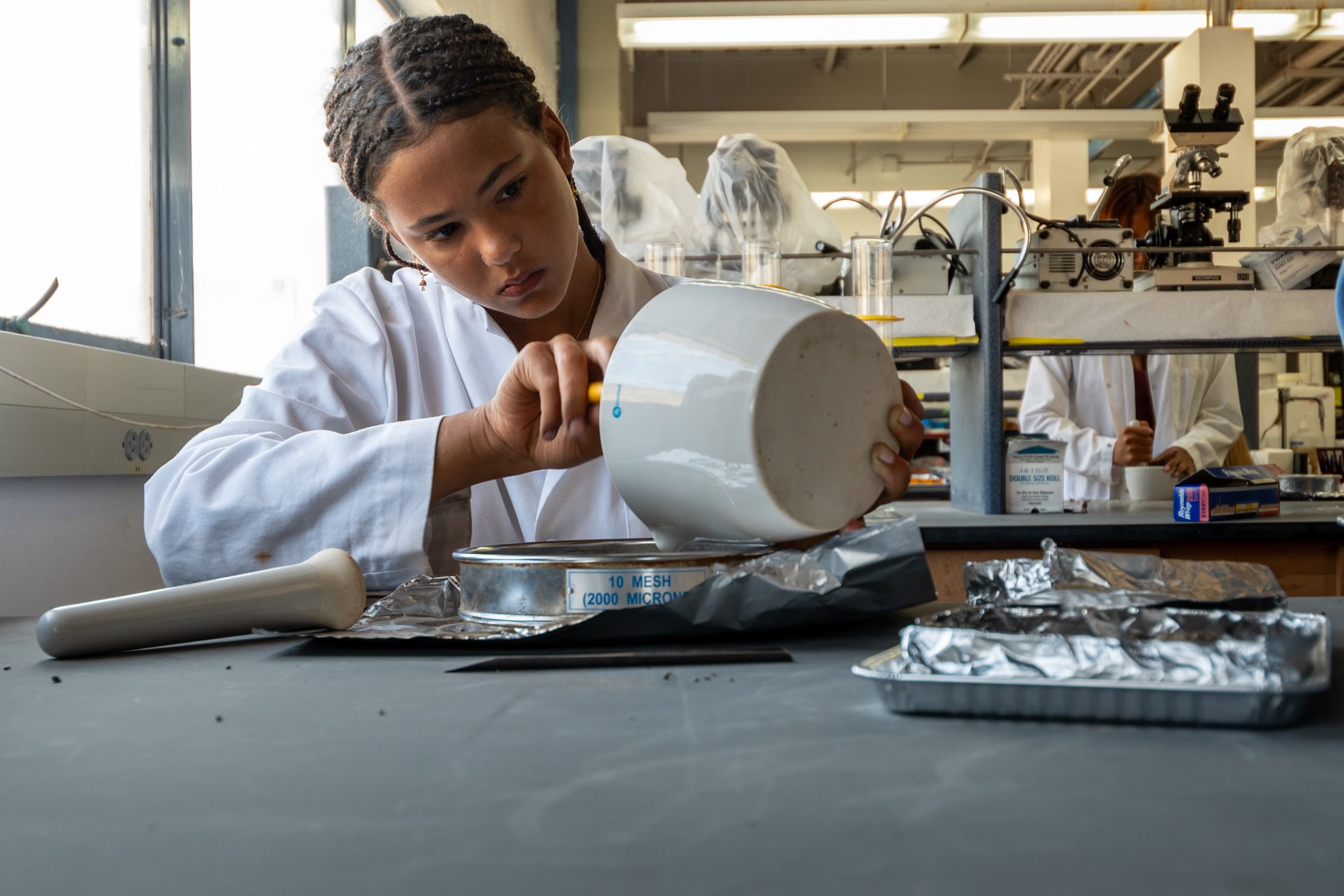
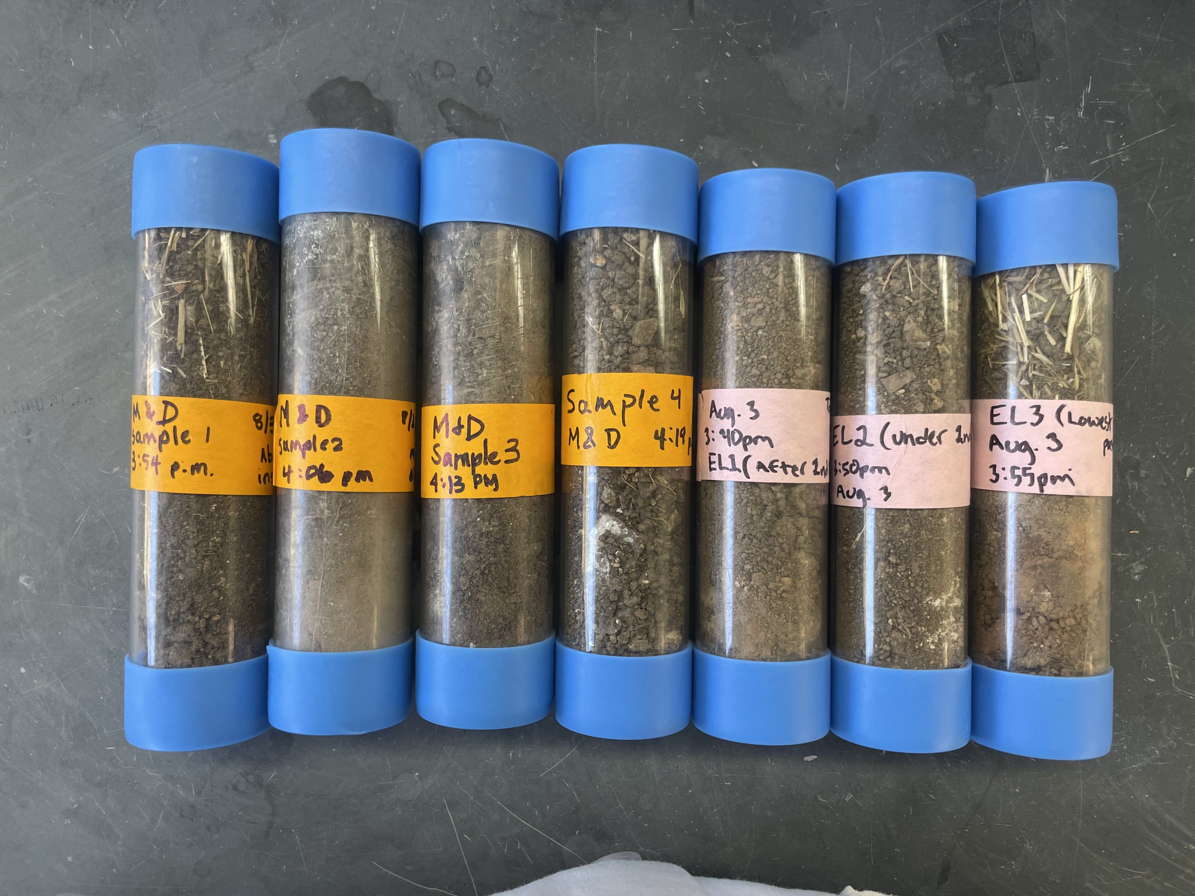
Emersyn: Depending on where the soil sample was taken, the soil was either dry and crumbly or dry and compacted, making it easy to take some of the samples while a few were quite difficult. Within the samples, there was gravel and small rocks and the soil particles themselves appeared large. Due to the presence of rocks and/or plants throughout the test plot, the samples were taken in a mainly random pattern wherever it was feasible. When breaking up the soil with a mortar and pestle to be able to sift it, many of the particles were tightly bound in small clumps.
Jen: What soil properties did you examine? Why is each one important?
Alia: The soil properties we examined were soil composition, soil texture, nutrient content and pH, bulk density, porosity and water content, respiration, and conductivity.
-
Soil composition tells us how much of the soil is solution, how much is air, how much is organic matter, and how much is minerals. This lets us know how well the soil can hold and provide nutrients for plants.
-
Soil texture is basically a measure of the composition of the mineral portion of the sand, so it reveals the content of sand, silt, and clay in the mineral part of the soil. This measurement gives us insight into how well the soil will hold water.
-
Nutrient content and pH are two characteristics of soil that are very important when discussing plant growth because plants need a balanced pH as well as a certain level of nutrients present in the soil to be able to thrive. Bulk density, porosity, and water content are all aspects of soil compaction and moisture, so they may affect the root growth of plants and how far into the soil those roots are able to reach.
-
Soil respiration is measured by the amount of oxygen released from soil over a given time period. This measurement is used as an indicator of microbial activity, so it can give us an indication of whether or not there are a lot of microorganisms at work in the soil.
-
Lastly, we measured the electrical conductivity of the soil. This is important because the thing that helps soil be a good conductor is salt content, so conductivity tells us if the soil has a high salt content that could be damaging to plants.
Jen: Is there any special equipment you need to perform these tests? Are there any of these tests that people can do at home?
Emersyn: Many of the tests we conducted can be done at home with some simple tools. To collect soil samples, we used soil core samplers to collect a precise amount of soil and to maintain the condition of the soil; however, a soil sampler probe could be used to collect samples as well. Testing for pH, nitrogen, phosphorus, and potassium are the easiest tests to do at home using a Rapitest soil test kit. To weigh the samples in bulk density, porosity, and water content measurements, a scale is needed as well as an oven. To measure soil texture, a sift, mortar and pestle, graduated cylinder, water, sodium hexametaphosphate, thermometer, timer, and hydrometer are needed. Other helpful tools include a hand shovel, a pen and tape for labeling, and tin foil. Tests for organic matter would require an oven that can reach 450℃, respiration tests would require a CO2 indicator, and salinity tests would require a soil EC meter, therefore these tests would be difficult to conduct at home.
Jen: How would you describe the soils in the Green Ravine?
Alia: The soil in the green ravine is very porous, it’s dry, and it has a low nutrient content. The main aspect of this soil that makes it unique is the fact that it is almost entirely newly settled sediment, so it is very loose soil. It falls in the bottom of a channel through which water that is often carrying a lot of sediment flows, which describes its low compaction. Its low water content and lack of nutrients may sound concerning, but they are not actually a bad thing. This is typical of this biome which means that the soil in the green ravine is very normal for a chaparral biome in all of its other aspects. It has coarse grain size because it is considered a sandy loam based on our soil texture data, which basically means that it has a lot of sand and a lot of silt, and not very much of it is clay which is the smallest soil particle. Overall, the green ravine soil looks like a loose, less compact version of healthy chaparral biome soil.
Jen: What were the results and takeaways?
Emersyn: The breakdown of soil components was 45.47% air, 42.54% mineral, 8.24% solution, and 3.75% organic matter.
-
The soil’s texture was overall a sandy loam composed of 65% sand, 18% silt, and 16% clay. This composition allows for good drainage of water, which is beneficial for the Green Ravine where one of the goals is to allow the water to infiltrate and percolate through the soil.
-
The average bulk density was 1.0742g/cm^3, and while this was low, it still indicates overall good soil health.
-
The average pH was 6.8, which falls within the ideal pH range for many native plants in the area. The soil was depleted in nitrogen, phosphorus, and potassium indicating a low cation exchange capacity, which is normal and expected for the environment as the tests used are designed for agricultural fields where levels are anticipated to be higher.
-
All the soil samples had a high concentration of CO2 possibly due to the Birch Effect, where the sudden addition of water to dry soil with typically limited water levels, causes a short-term spike of CO2 output with higher microbial respiration and activity levels.
-
Finally, the soil was non-saline. The conductivity of the soil was 0.17dS/m, while the USDA defines saline soil as being higher than 1dS/m.
Taking all our measurements into consideration, a few takeaways could be made. Firstly, as Alia mentioned, the soil is typical of its biome. The arid landscape of a chaparral biome creates soils that have high porosity, are nutrient-poor, dry, and have a coarse grain size, all of which were observed in our soil samples. So while these conditions aren’t necessarily ideal for agricultural production, we concluded that native plants will likely do well as they have been well adapted to thrive in this type of soil. This was great news because it meant that the Test Plot was suitable for the restoration that would be taking place in the following months. Secondly, there weren’t any large differences between the soils taken before and after the two check dams in the Green Ravine, which was likely due to our distribution and random choice in sample location. To properly assess how well the check dams work, more samples right before and after each should be taken in the future. Lastly, the lower bulk density of the soil had to do in part because most of our soil samples were taken within the part of the Green Ravine where the water stream was flowing, therefore there was less organic matter and plant growth in that area. Additionally, with a large amount of rain from this past winter, sediment from upstream had recently been displaced and loosely consolidated in that part of the ravine as well, making it less compact than soil in a field would be.

